Text and Photos (c) Robert Barry Francos/
FFotos by Francos, 2020
Photos can be enlarged by clicking on them
The Forks is located relatively near Prince Albert, Saskatchewan, which is normally about a three hour drive from Saskatoon normally, but we took a scenic route, up Hwy 41 and then smaller, sometimes gravel roads, through Smuts, Wakaw, Meskanaw, and Weldon. We also stopped along the way to take photographs, as we are wont to do.
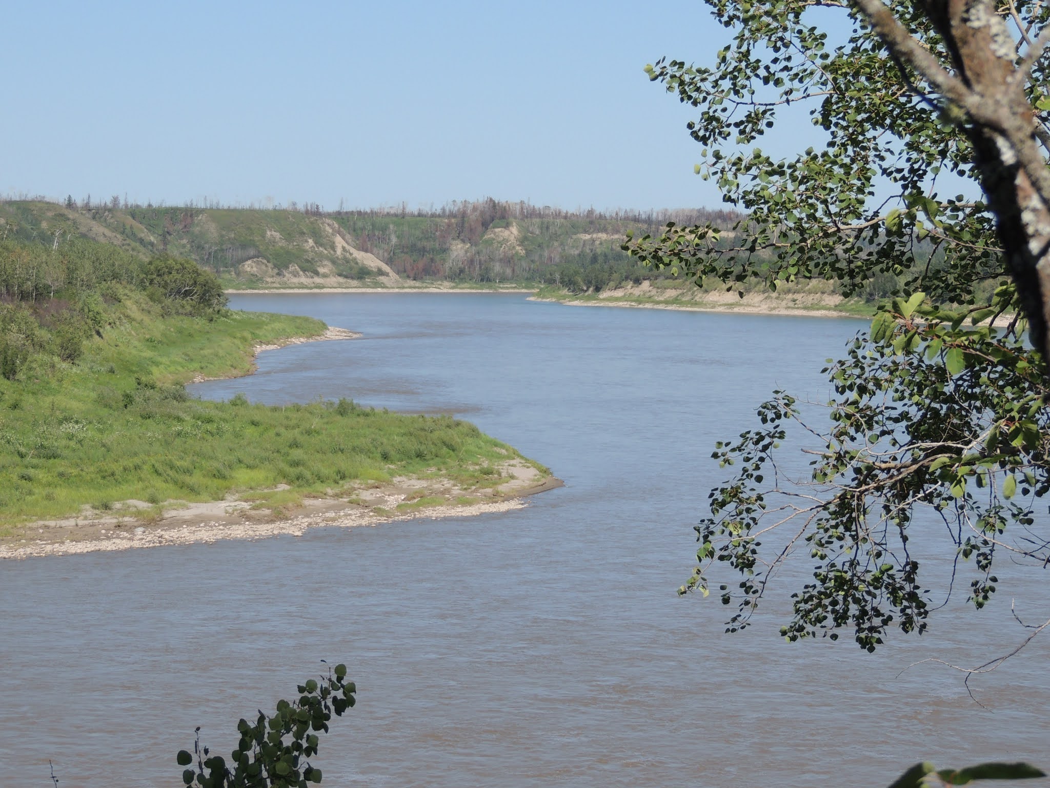
It is called The Forks, because it is where the South Saskatchewan River meets the North Saskatchewan River, and becomes the Saskatchewan River (type that three times fast, I double-dog-dare ya!). The trail down to the Forks from the parking lot is technically closed, and certainly not maintained. It was a really tough go for me considering my current physical condition, but I made it in part through the help of my three companions and their dogs. I will explain somewhat along the way.
Our first stop was the ghost Hamlet of Smuts - yes, Smuts - which is also the site of two magnificent-yet-closed churches, the first being St John the Baptist Ukrainian Greek Catholic Church, built in 1905, and the other Holy Trinity Ukrainian Greek Orthodox Church, built 1926. The two churches are three kilometers apart. After that, we took a drive into what used to be the center of the hamlet, which is mostly ruins.
 |
| Taken through car window, I like how the sun reflection plays with the cross. |
 |
Blindly taken through a closed window higher than my head.
|
 |
It's not your vision, it's really that faded.
|
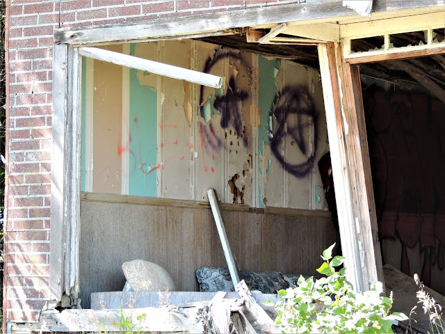 |
The graffiti included pentagrams and the word Hex on the wall
|
 |
| What attracted me to take this image was the wrecked bicycle in the foreground. |
Meskanawa, SK: Saskatchewan's longest trestle bridge, functional from 1929 until 1975.
Elevators at Weldon, SK; both are closed.
The Weldon Ferry, which crosses the South Saskatchewan River. There is no fee.
The Forks: view from the top of the trail (parking lot) of the Saskatchewan River, with the North Saskatchewan on the left, and the South Saskatchewan on the Right.
View from the bottom of the trail.
The trail to the La Colle Falls Hydroelectric Dam, which was never completed. I did not take this part of the journey, and waited in/with the car.
 |
| Note the graffiti and the Molsons/Tim Horton's litter. |
 |
| I know it's only a mistake photo, but I like it (as the Stones may have said). |
 |
Canola Fields
|
Back to the Weldon Ferry on our way home, with a beautiful sky on a very hot day.


